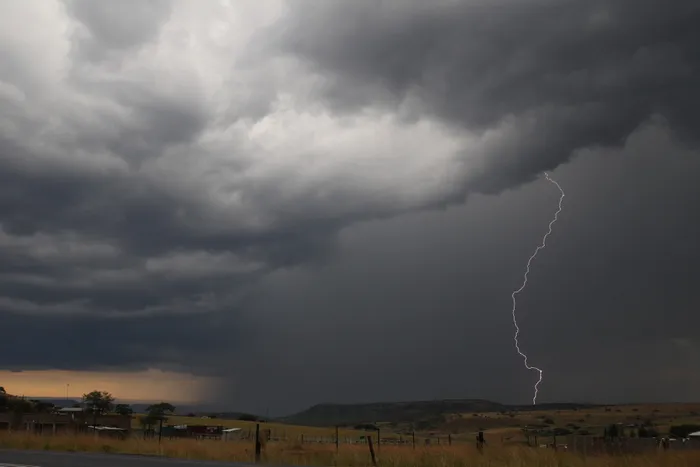
The SAWS has issued a Yellow Level 2 weather alert for severe thunderstorms in the Limpopo and Mpumalanga.
Image: Doctor Ngcobo/Independent Newspapers
The South African Weather Service has issued a mix of weather alerts and conditions for Thursday, bringing both severe thunderstorms and rough seas to parts of the country, alongside fair conditions in the central regions.
In the Limpopo and Mpumalanga provinces, a Yellow Level 2 Warning has been issued for severe thunderstorms. Residents in areas including Polokwane, Phalaborwa, and Mbombela can expect strong damaging winds, large hail or small hail over large open areas, along with localised flooding in vulnerable areas such as roads, bridges, and settlements.
There is also a high risk of excessive lightning. The forecast indicates a 60% chance of scattered showers and thunderstorms in these regions, highlighting the severity of the storm threat.
Along the southern coastline, from Cape Columbine to Plettenberg Bay, a Yellow Level 1 Warning has been issued for damaging waves. Difficult navigation conditions are expected due to wave activity, which coincides with cooler coastal temperatures and strong winds reaching up to 45 km/h near the Atlantic coast and 50 km/h near Port Shepstone.
A 30 to 60% chance of showers is predicted for coastal towns like Cape Town, George, and Port Elizabeth.
In contrast, the central interior regions including Kimberley, Bloemfontein, and De Aar are expected to remain dry and warm with no rainfall forecast (NIL). Clear skies and fine weather are anticipated, especially in areas around Prieska and the Northern Cape, offering a break from the otherwise active weather patterns.
Temperatures will vary widely across the country, with hot conditions expected in the far north near Musina and Upington, while the south and eastern parts of the country will remain cool to warm.
IOL News